 |
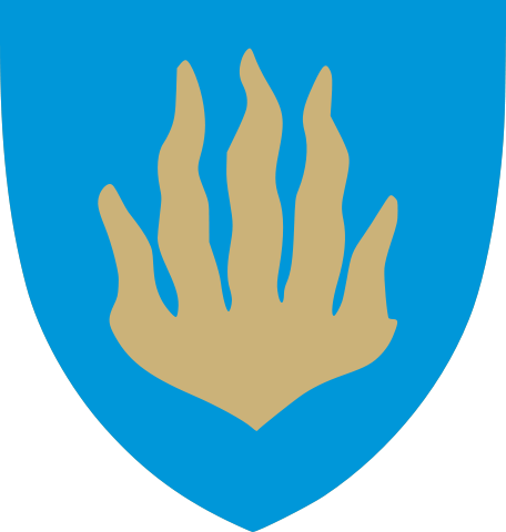
Hurum kommune
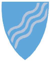
Hurum takes up the southern part of the peninsula between the
Drammensfjord and the Oslofjord called Hurumhalvøya.
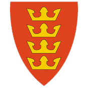
Its geography is
reflected in its shield. It is connected to Akershus by a 4 1/2 mile
tunnel beneath the Oslofjord. Hurum shares the peninsula with the
municipality of Røyken. The administrative center of
Hurum is Sætre.
Hurum kirke is the parish church for
Hurum. There has been a stone church there since 1150. In 1686
a fire did great damage to the building. The church underwent a
major renovation in 1849. One of its most precious possessions is
the pulpit, gifted by Kirsten Huitfeldt in honor of her husband
Ivar, a naval hero who died during the Great Northern War in 1710.
The other churches in the district
include Flitvet, Holmsbu, and Kongsdelene.
|
| |
Links |
|
|
|
|
Hurum Kommune website |
|
|
|
| |
|
|
|
R-DD Genealogy Library
606 1900 Folketelling
Holmsbu
Produsert: 12-Apr-1996
Eier, Sigfred L. Hurums
historie. Hurum: Hurum bygdeboknemnd, 1963-1969. :2 bind.
Bygdehistorie inntil 1807. Volum: (1) 1963.:X, 494s
Bygdehistorie 1807-1940. Volum: (2) 1969.: VII, 571s
606 1900 Folketelling
Holmsbu
Produsert: 12-Apr-1996
Kirkeboker Films: Hurum
1715-1928
Sorensen, M., Hurum
Information Book.
Ringerike, Drammen Districts Lag Genealogy.
St. Paul, MN
Hurum Kommune, Kommuneplan
2000-2012
Hurum Telephone Directory
1999-2000
Brochure/Map of Modum Area,
1977
|
|
|
|
|
|
|